Background
Few areas in Lancashire offer so much of interest to the archaeologist and medieval historian as Whitworth.

Why? Quite simply, little recent archaeological research has been done, and that which has been undertaken has failed to record visible monuments, such as Naden Head and the associated archaeology as well as newly discovered sites in south Whitworth (prehistoric and medieval).

The 1982 Manchester University excavation at the prehistoric cairn at Hades Hill was never published.
The medieval documentation for the area is striking: nearly 100 charters relating to Whitworth alone are recorded in the Coucher Book of Whalley Abbey.
A more detailed survey and study of Whitworth’s archaeology and medieval documentation is certain to reveal much of interest.
With high mesolithic site desity and a large number of medieval sites documeneted one wonders about the archaeology of the area between these epochs.
Archaeology
No systematic archaeological survey of Whitworth has been undertaken, so many sites remain to be discovered and recorded.
Mesolithic
Many mesolithic sites have been recorded in the Rochdale area, and the density of sites indicates that the area was used by hunter-gatherer communities at this time. In fact the density of sites is one of the highest in Europe. Mesolithic flints were found at Hades Hill, for example (see Littleborough Museum Worksheet 87). The site also has a Bronze Age cairn and may indicate continuity of use from the Mesolithic to the Bronze Age.
Neolithic
Few Neolithic sites in the area have been researched recently. Known prehistoric sites left few extensive earthworks or stone alignments/settings. It is possible that sites used wood constructions that are no longer evident, or were destroyed, or robbed for stone, by later generations.
Bronze Age
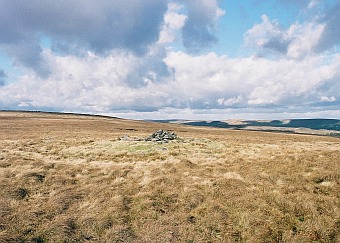
Bronze Age sites can still be seen in the Whitworth area, though after around 3,000 years we can expect some damage. The main sites are burials, evident at Bagden and Hades Hill which are of a similar form and size.
Other sites exist in the area on Rooley Moor and east of Whitworth too, and more work is needed to confirm the nature and age of these sites. How these sites relate to local finds from the Bronze Age has not been researched yet. With detailed survey, the number of surface finds and sites will, no doubt, increase. The fact that the climate was at its best in the Bronze Age perhaps explains why this prehistoric period has the largest number of sites compared to other prehistoric epochs, such as the Iron Age.
Barrow discovered in south Whitworth! more news soon!
Iron Age
Finds from the Iron Age are rare in this area, however this does not mean that the area was unoccupied. Many of the sites are probably obscured, or have been destroyed by later settlements. Surviving Celtic place-names in the area may indicate good locations to look for archaeologicayl evidence. Lake Kor, now lost, is one possible site. It is recorded in the Coucher Book of Whalley Abbey as being near Prickshaw.
A site with a triple ditch, discovered in 2010 ma well be iron age in date with later use, such a site would normally have been identified many years earlier as is the case for an adjacent with a clearly visible bank. Both areas are mentioned in medieval documents.
Roman
Roman coin hoards have been found in the Rochdale area. How these relate to any settlements is unknown, as is the relationship to forts at Manchester and Castleshaw, for example.
Early Medieval
The first reference to the Rochdale area is in the Domesday Book. It would appear that Rochdale had some autonomy and appears to have been administered by an Anglo-Scandinavia thegn, Gamel, based in Calderdale. The large area of Rochdale parish and the reference to Rochdale as a “wapentake”, a Scandinavian term for a county sub-district supports this hypothesis. Additionally, the recording of Scandinavian names such as “Dolfinus of Healey” in medieval charters, and Scandinavian place-names such as Sike and Ding (a meeting place for local administration), indicates Scandinavian settlement in the area.
This Scandinavian settlement is important in understanding the number of medieval charters relating to Whitworth in the Coucher Book of Whalley Abbey. Rather than being dominated by a single feudal landowner, several Whitworth freeholders were able to grant land to the Abbey. Perhaps Scandinavian settlement in the area led to several freemen owning farmsteads in the area, some places such as Bagden and Harsenden may well have been occupied before their mention in 13th-Century charters.
Medieval
Whitworth has an exceptional number of medieval charters for a village, perhaps ten times more than would normally be the case for an English village.
Whitworth people mentioned in the Coucher Book of Whalley (12th and 13th C.) They range from “Agnes” to “Wiilmus”. Whitworth was “Whitword” in medieval times.

Sokemen
This can perhaps be explained by “sokemen” freemen who owed minor service to their lord and could sell and exchange land, which could be inherited by their children. In the 1626 Manor Survey of Rochdale a Mr Chadwick, who held land “”in sokeage” the south of Whitworth. Ownership of land would have given sokemen more incentive to develop and improve their land.
When the 16th-Century records of Whitworth farmsteads in the Coucher Book of Whalley Abbey are combined with fieldwork and the translation of medieval documentation, it should be possible to plot many of the settlements and boundaries mentioned in charters.
A detailed chronology of land transfers in the Coucher Book of Whalley Abbey can be found in C. D. King’s thesis of 1991.
King, C. D . – The Whalley Coucher book and the dialectal phonology of Lancashire and Cheshire 1175-1350 . – University of St Andrews PHD Thesis, 1991 (Unpublished).
This thesis is now available for free download by individuals via the British Library’s EThOS service http://ethos.bl.uk
Economic Activities
Economic ties with Whalley Abbey ranged from wool to iron-working. Farmsteads with small cultivation plots combined with communal pasture for sheep and cattle, would have been the characteristic settlement pattern. The highest land would have been for grazing in the Summer. Surprisingly if the land was south facing and of reasonable quality it could be used for farming up to 400 m OD. Some fields were just used for hay although a type of field system dating back to prehistoric field systems was used in Rochdale.
Still Visible
You can still see extensive signs of earlier field systems and boundaries East of Hamer Hill and down through, Withens, Bagden, Bartle Cowm and Meadows for example. These places and land boundaries are often mentioned in medieval cgarters from The Coucher Book of Whalley Abbey.
Vaccaries
There are place-name and documentary evidence for vaccaries (medieval cattle ranch) in the area, one rural site has recently been identified,
By the 16th-Century, local freeholders worked together to build a local chapel in Whitworth.
Bagden and other farms, their associated boundary ditches, and old cultivation can still be seen to the west of Whitworth. Mention of a medieval bridge, corn and fulling mills and iron smelting indicates many opportunities for future archaeological research.
Early Modern
The 1600s saw an expansion in stone building in the Whitworth area, at Cock Hall and Smallshaw, for example. The manor surveys of 1610 and 1626 give many detailed accounts of settlements in the area.
Coal mining was also recorded in the 1626 Manor Survey – it became increasingly important as timber supplies were depleted. Wool and textiles were becoming increasingly important in the area by the 16th-Century, cutlery production (at Cutler Green) was another local economic activity, as was quarrying.
Conclusion
Archaeologists and historians have overlooked Whitworth and the Rochdale area. The lack of research has led people to conclude that the area was sparsely populated. However, 16th-Century moorland assarts (area enclosed for cultivation and farming), like that at Birchen Holts, would appear to show that marginal land was being used as population levels were recovering from the ravages of the Plague and land was in short supply. Settlement patterns in Whitworth mainly comprised single farmsteads, many of which are still farms today, and earlier boundaries and cultivation can still be seen.
Medieval Whitworth Places
Here is a list of Whitworth places mentioned around 800 years ago, there are so many and quite a few have gone from the map.
With so much to discover and research, Whitworth’s past will keep future generations occupied for some time to come!
References
Specific references to Whitworth can also be found in the Lancashire Assize Rolls, See Lancashire Assize Rolls: 4 John – 13 Edward I (pp. 393-439) here.
Hugh de Whitworth
Ivo de Whitworth
Jordan de Whitworth
Ranulph son of Jordan de Whitworth
William de Whitworth.
Read more about Medieval Whitworth here.


A large scale Arts/Heritage is planned for the Whitworth area and I need archaeological contacts for the area, any ideas please?
Great choice of area, I will be happy to help.
You’d better hurry up then Helen! Coronation power are going to rip a 30mtr wide corrider out of the hillside
from landgate 4miles up through middle hill and hades quarry to crooks hill where they are going to put a windfarm.The road they propose to build is going to have to take 130ton transporters and cranes and tons of rd ballast and cement for the bases. All will be destroyed. The access comes to planning at rossendale next month.
If you know a way of stopping it please let me know .
Cllr david barnes
deputy mayor of whitworth.
are you still looking into doing this?
Yes, planned for next year.
Yes!
This is great news,a man in Whitworth as found a bronze axe head up there,pleace come before they start the windfarms.
when is it coming?? my mother (the mayor) has always something like this would be good for whitworth
You will have to ask those responsible for managing your heritage. Since the area has not been fully surveyed many sites are still not on official records, that includes OS maps.
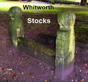
I am looking for information about the stocks. The plaque says a Dick Tattersall of Stid farm was the last man to be held in them, but there are no dates. I have come across local folklore about a drunkard named Dick from Stid but again, no dates. How can I find this information?
The libraries can help you find the parish, court and other records related to this. I
I don’t live locally anymore. What is the name of the local library so I can contact them online? I am doing my family history and the Tattersalls married into one line.
I think the local museum/Historical Society can help, contact:
https://www.whitworthhistoricalsociety.org.uk/contact.html